
 Facebook
 X
X
 Pinterest
 Copy Link
Dinosaur Bones, Outlaws and Moonshine – Three Places to Visit Outside of Vernal, Utah

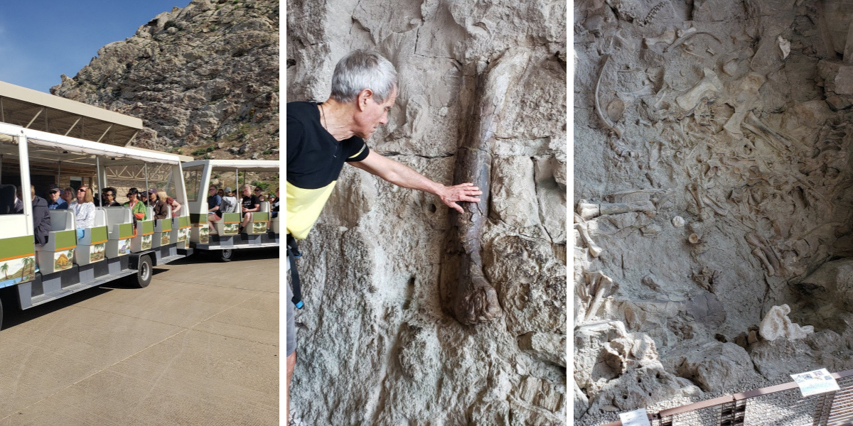
Dinosaur National Monument, the Outlaw Country scenic drive, and the Moonshine Arch are three places to try to visit just outside of Vernal, Utah. The Dinosaur National Monument is a national park located on the border of Utah and Colorado and covers 210,000 acres. The Quarry Visitor Center is located in Jensen, which is southeast of Vernal, Utah. Shuttle buses will take visitors to the Quarry Exhibit Hall where you will see a wall of nearly 1,500 dinosaur bones. A few of the 149 million year old fossils are identified permitting you to touch them, while others can be viewed from several feet away. The National Park offers scenic drives, and walking trails. If you are traveling with pets, be sure to be familiar where pets are permitted. Pets at Dinosaur National Monument
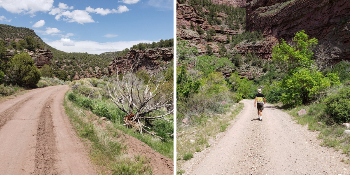
Outlaw Country scenic drive is an approximately 85 miles loop that travels through some of the most picturesque parts of the country. Be sure to have a full tank of gas and carry plenty of water. You will be traveling through Crouse Canyon, Brown’s Park, Jarvie Historic Ranch, and Jessie Ewing Canyon. Butch Cassidy and the Wild Bunch and other noted outlaws were known to stay in this remote area. The Jarvie Ranch has been historically reconstructed. Crouse Canyon with its red-rock walls is a beautiful drive, but you will need a high clearance vehicle to get by sections of deep ruts in the road. Driving Directions for Outlaw Country
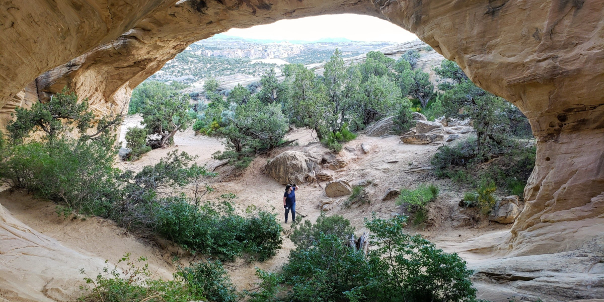
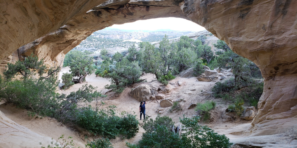
Just eight miles outside of Vernal, and a short distance from the road is an opportunity for a short hike to an incredible natural sandstone arch that is 85 feet long and stands 40 feet above ground. The hike to Moonshine Arch is approximately 1 mile, with an elevation gain of 290 feet. Read my previous post on Moonshine Arch for directions and additional information.

Hike and Soak at the Diamond Fork (Fifth Water) Hot Springs Trail

Fifth Water Hot Springs
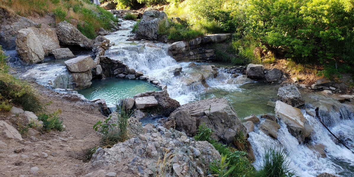
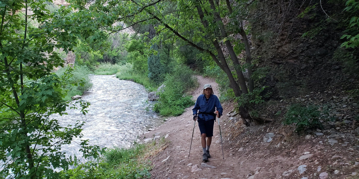
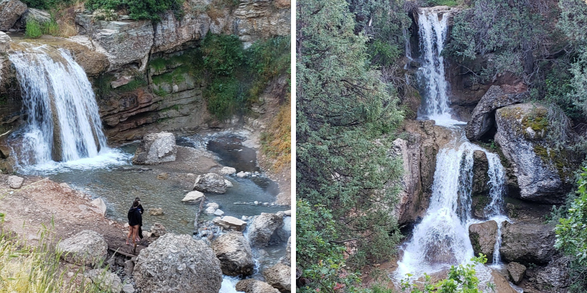
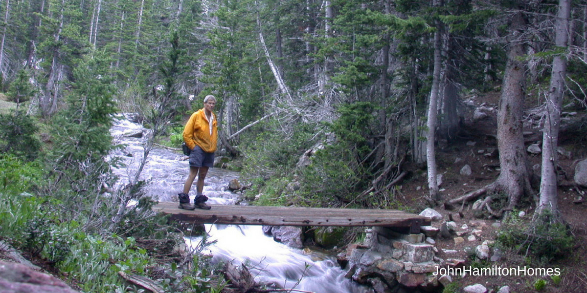
Enjoy a scenic hike on the Diamond Fork Hot Springs Trail, and take a leisurely soak in the hot springs before heading back. It is a 4.5 miles in and out trail with a gradual elevation gain of approximately 700 feet. The trail is mostly shaded and runs alongside the water. Listening to the sounds of the running water and the birds singing makes it a very pleasant walk.
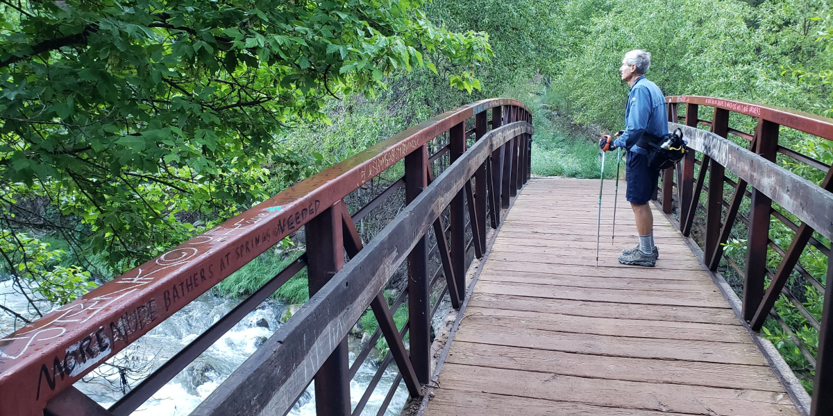
When you reach the bridge, you are approximately half way to the hot springs.
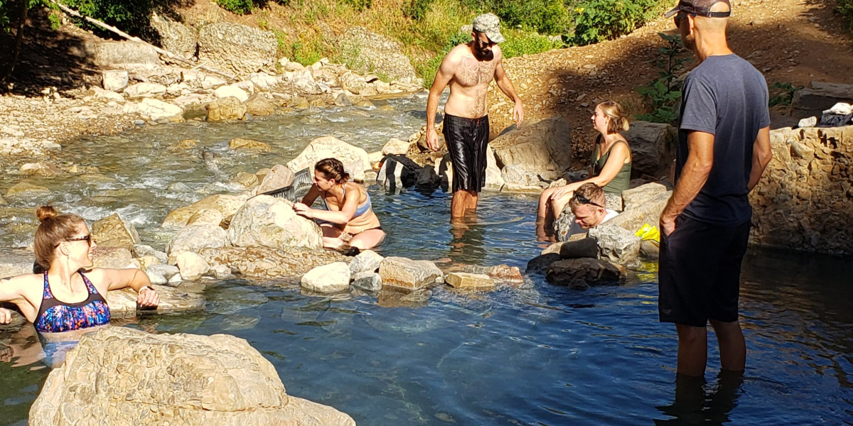
As you get closer to the hot springs you will begin to smell sulfur. The main pools are below the first waterfall.
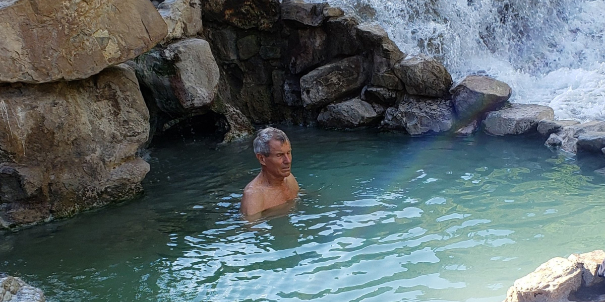
A second waterfall is located just a short way above the first one. There are two soaking pools along the stream between the first and second waterfall.
Dogs are permitted on the trail, but must be kept on a leash. Dogs are not permitted in the hot springs. There are no fees to park or to use the hot springs.
Be aware that rattle snakes as well as non-poisonous western hognose snakes aka “blow snake” may be found on or near the trail or by the hot springs. It is best to ignore them and they will ignore you.
It is important to not leave food or garbage on the trail, because it will attract rodents, which then attracts the snakes. Please be sure to carry out everything you bring in.
Another option for picnicking would be to stop at the Red Ledges Picnic Area (approximately 3 miles south of the 3 Forks Trailhead parking lot). It offers picnic tables, grills and restrooms. There are also red rock formations and an arch created by wind and water to explore.
Click for information about campgrounds.
Directions: It is approximately a one hour drive south of Salt Lake City. Take the Spanish Fork Exit 257 off of I-15, and head east on Hwy 6 for 11 miles. Turn left for the Diamond Fork Campground. Continue driving for 9.9 miles to the parking lot for the 3 Forks Trailhead. The trail starts at the gate near the restrooms.
Additional hikes you may enjoy:
Take a Seat on the Living Room Hiking Trail
Ogden’s Waterfall Canyon Trail
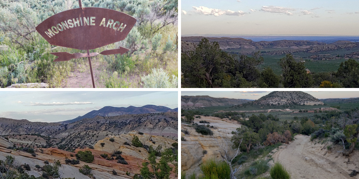
Moonshine Arch – Hidden in Plain Sight
Fall Foliage Makes the Wind Cave Trail a Colorful Hike
Moonshine Arch – Hidden in Plain Sight
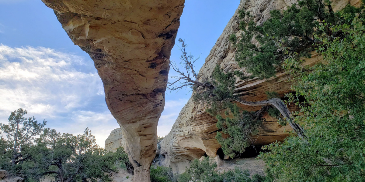

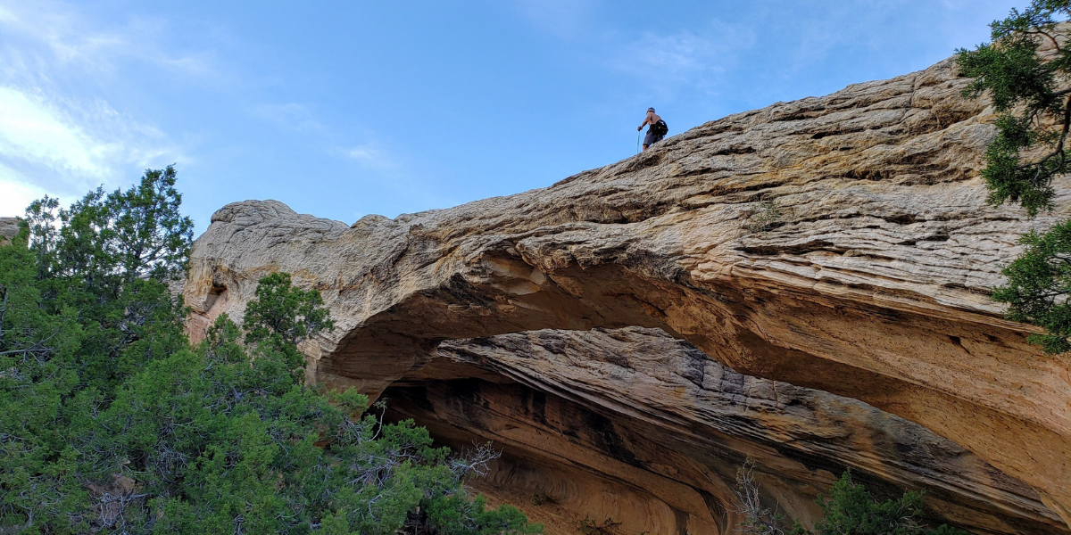
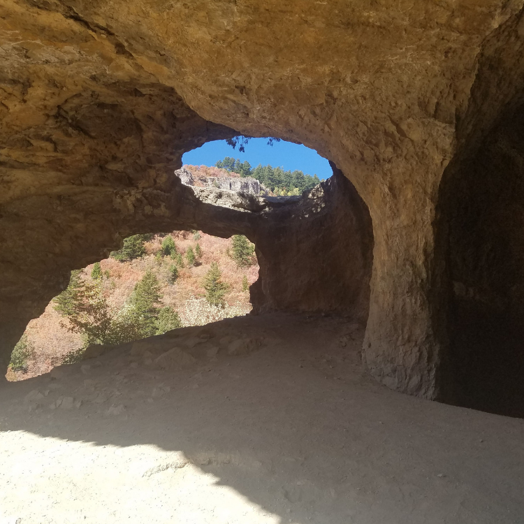
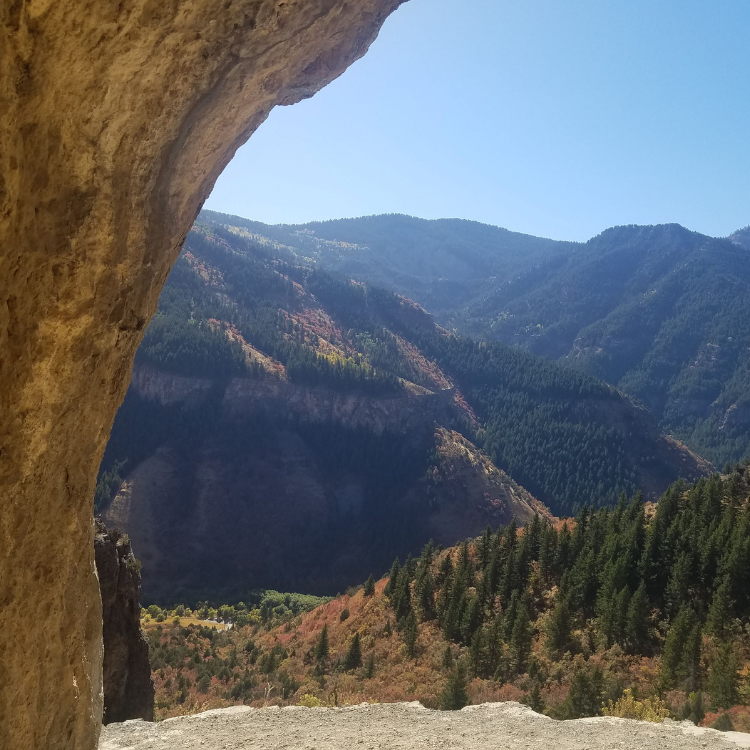
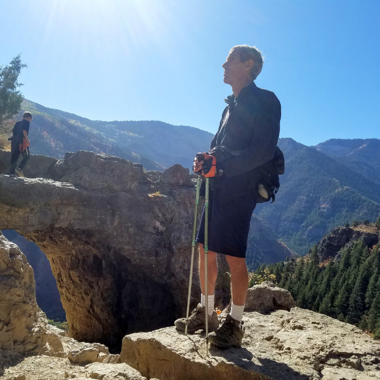
It would be easy to miss Moonshine Arch as you are leaving Vernal on Highway 191. Less than a mile north of the entrance to the Steinaker State Park, you will find an unmarked dirt road to the left. Take a left on this road and travel for approximately a half of a mile to turn on a wide dirt road. (Links to maps are included below). The arch rises 40 feet above the ground, and is 85 feet long, but is hidden from view by the surrounding landscape until you are in front of it. It is worth your time to search for it. The arch is accessible by jeep, ATV or by an easy hike.
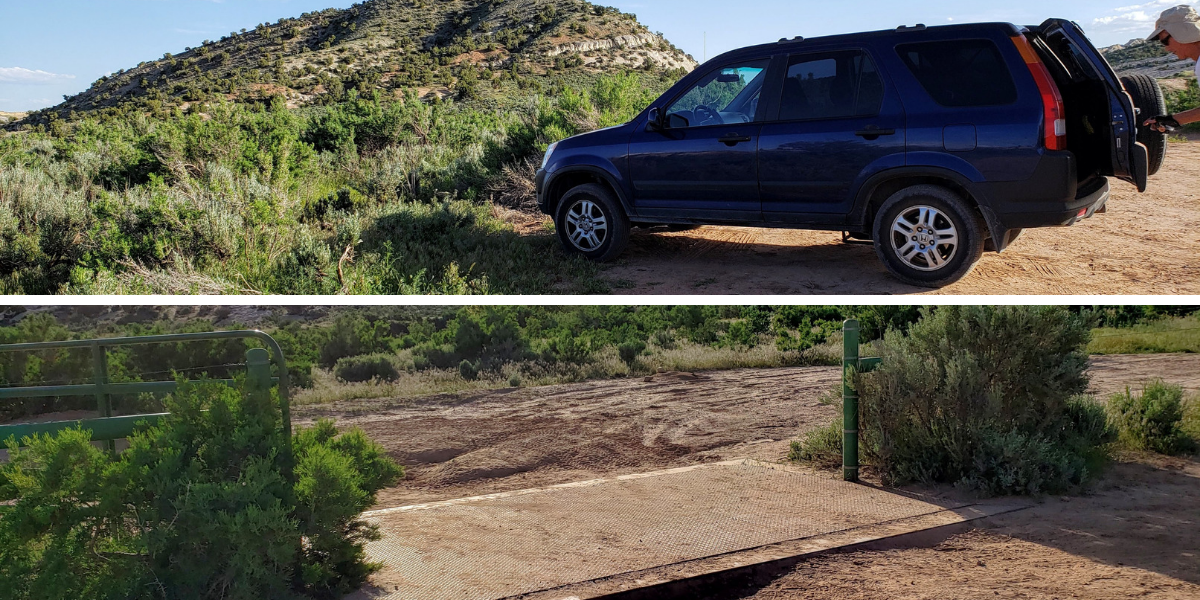
If you don’t have a high clearance vehicle, it is recommended that you park in the area outside of the green gate. The majority of the trail is sand, and slick rock. The arch is approximately one mile from the green gate.
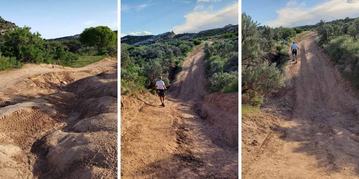
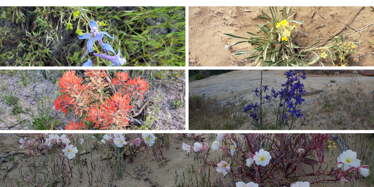
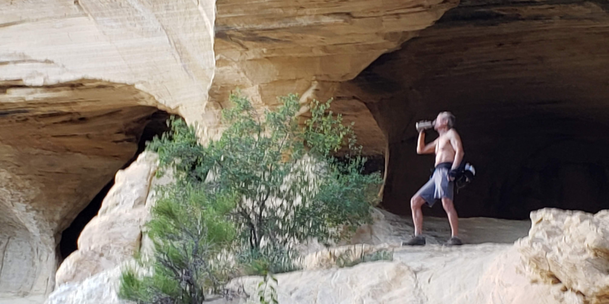
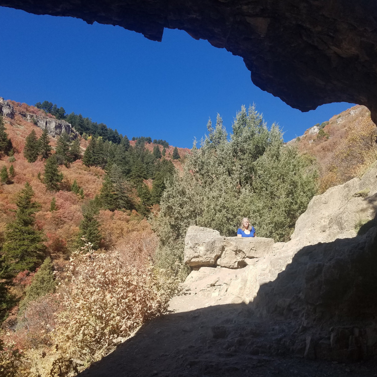
It is a pleasant walk with a variety of plants and flowers along the trail, and with great views. When you reach the arch, you will find caverns which would be a great place to enjoy a picnic in the shade. Dogs are permitted, but be careful in hot weather to ensure the sand and slick rock is not too hot for their paws.
I would recommend hiking during the early morning or early evening to avoid the hot sun during the day. Be sure to wear a hat, and to bring plenty of water.
There are no fees to access. You can find directions for the trail at these sites.
Other interesting hikes:
Ogden’s Waterfall Canyon Trail
Fall Foliage Makes the Wind Cave Trail a Colorful Hike
Cascade Springs – Accessible Nature Walk
Take a Seat on the Living Room Hiking Trail
The Maybird Gulch Trail – A Trail Less Travelled
Fall Foliage Makes the Wind Cave Trail a Colorful Hike
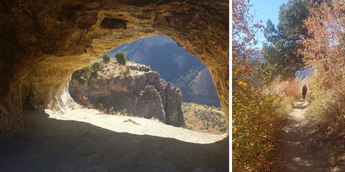

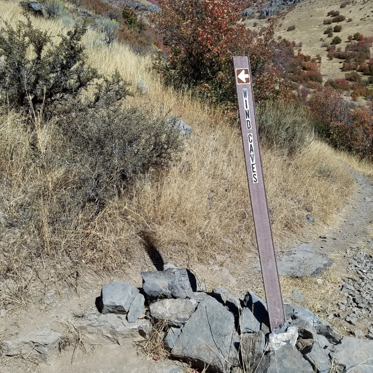
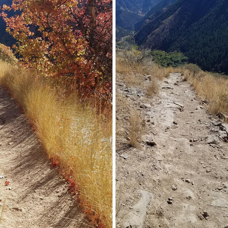
Wind Cave Trail, Logan, Utah
Fall is the ideal time to hike the Wind Cave Trail to see the colorful foliage. Driving approximately 5 miles up the Logan Canyon National Scenic Byway, you will find the Wind Cave trailhead across the road from the Guinavah-Malibu Campground.
The Wind Cave is composed of a group of natural limestone arches and hollows. It was formed as water seeped through cracks in layers of underground limestone, creating caverns. Downward cutting from the Logan River exposed the caves, and the arches were created by water continuing to erode the limestone.
The trail is rated moderate with an elevation gain of approximately 1000 feet. It is 3.5 miles round trip. The elevation gain does not appear as steep due to switchbacks. The trail is well maintained and is clearly marked. If there is an unmarked trail that leads off, stick with the wider trail.
There is shade for the first half of the trail; however the last half does not have shade. It is advisable to dress in layers, wear a hat and protection from the sun. Be sure to bring plenty of water.
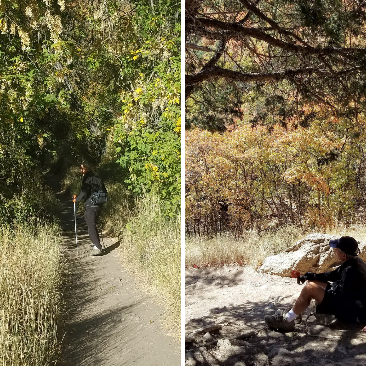
The trail is heavily trafficked at times, particularly during the weekends. If you prefer to hike when less people are on the trail, weekdays are a good option. Dogs on leashes are permitted.
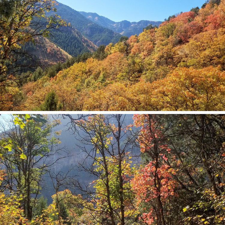
The Wind Cave Trail is extra colorful with the fall foliage
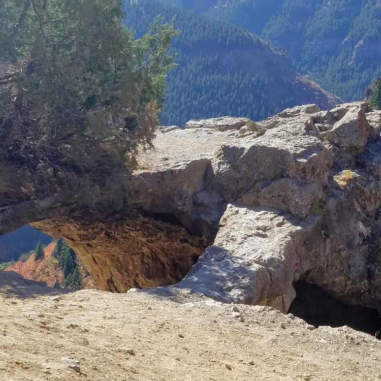
The end of the trail leads to the top of the cave. If you have children with you, be sure to watch them carefully as there are steep drop-offs. You can climb down into the cave and explore the alcoves. It is a great place to rest in the shade of the cave and take photos of the gorgeous views.
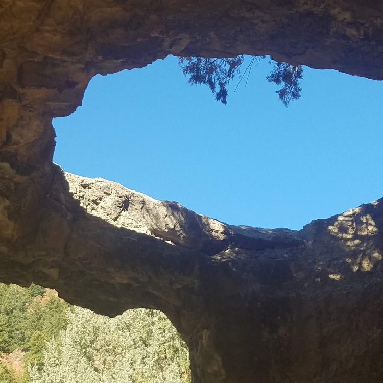
The Wind Cave has two alcoves
Other interesting hikes:
Ogden’s Waterfall Canyon Trail
Moonshine Arch – Hidden in Plain Sight
Cascade Springs – Accessible Nature Walk
Take a Seat on the Living Room Hiking Trail
The Maybird Gulch Trail – A Trail Less Travelled
The Maybird Gulch Trail – A Trail Less Travelled

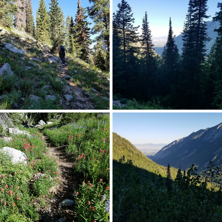
John Hamilton crossing the bridge leading to the Maybird Gulch Trail from the Red Pine Trail
White Pine, Red Pine Lake and the Maybird Gulch Trail each start at the same trailhead. The Maybird Gulch Trail is the path that is least travelled, but offers solitude along with stunning scenery. No fees or permits are required. It is a watershed area and no dogs are permitted. The hike is best during the summer and fall, as snow will be in the higher elevation into mid-June.
The trail is a dirt path with rocks and has an elevation gain of approximately 2,000 ft. It is excellent hike for birding, photography, wildflowers, wildlife and to see fall colors. Aspen and evergreen trees offers some shade, but be sure to bring plenty of water and wear clothing that will offer protection from the sun. There are three small lakes, but no wading or swimming is permitted in the watershed lakes.
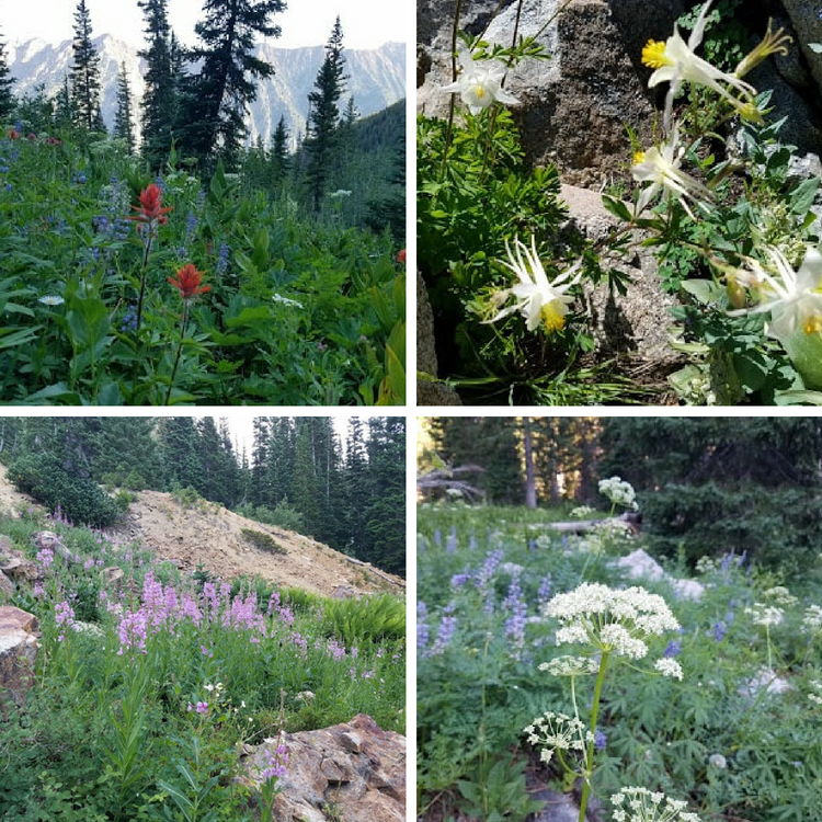
Wildflowers on the Maybird Gulch Trail
How to get there
Drive up Little Cottonwood Canyon for 5 ½ miles. The turnoff is on the south side of the road right after the “White Pine Slide Area” sign. There is a restroom at the beginning of the trailhead. A quaint footbridge gets you across the Little Cottonwood Creek. The trail gradually climbs to follow an old four wheel drive road, which is now closed to motorized vehicles. The old road is now a wide trail and after about a half-hour from Cottonwood Creek the trail splits and takes a sharp left to the White Pine drainage. Take the right trail west toward the Red Pine drainage, as the trail climbs a bit south before crossing the wood bridge over the stream.
The trail then gradually climbs as it traverses west and you enter the Lone Peak Wilderness area, offering some marvelous vistas of the Salt Lake valley to the west. The trail then steepens and finally reaches the Maybird Gulch turnoff to the right where the trail converges with the Red Pine stream, and you there’s a small bridge to the right which takes you to the Maybird Gulch trail. If you happen to miss the bridge and get to the mine tailings just above the junction, just head back a few minutes and you’ll find the bridge.
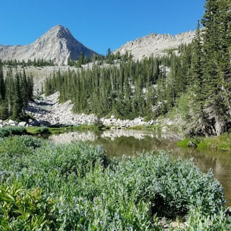
You will enjoy the solitude of the Maybird Gulch trail, it’s easy to follow as it winds its way to the west and south into the Maybird Gulch drainage. You will start to hear the birds and notice the abundance of wildflowers. When you get to the lakes, you will have stunning views of the Pfeifferhorn, which is the fifth highest peak in the Wasatch Range at 11,325 feet.
Other interesting hikes:
Ogden’s Waterfall Canyon Trail
Moonshine Arch – Hidden in Plain Sight
Fall Foliage Makes the Wind Cave Trail a Colorful Hike
Cascade Springs – Accessible Nature Walk
Take a Seat on the Living Room Hiking Trail
The Historic Union Pacific Rail Trail State Park
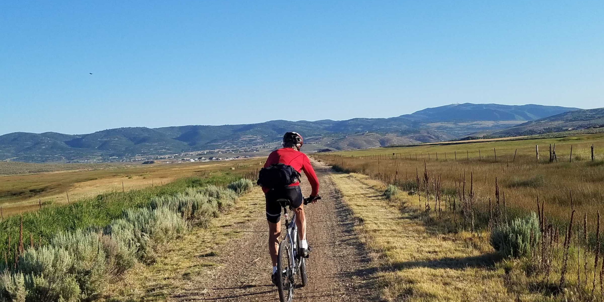

John Hamilton riding on the Union Pacific Rail Trail
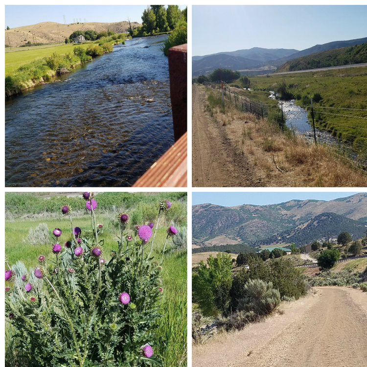
The Historic Union Pacific Rail Trail offers 27.7 miles of recreational fun for mountain biking, hiking, horseback riding, wildlife viewing and cross-country skiing. The majority of the trail is gravel. There is a 3 mile section in Park City, and a half mile section in Wanship that is paved asphalt.
Over 100 years ago, the Echo-Park City Railway transported coal and silver ore. In 1989, the Union Pacific abandoned the railroad line. The railroad line was transformed into the first non-motorized rail trail in Utah. The Historic Union Pacific Rail Trail State Park was opened to the public in 1992.
The trail begins at an approximate elevation of 6,900 feet in Park City and gradually descends to 5,280 feet. If you are biking, be sure to bring an extra tube and a tire repair kit with you. Having a fully charged cell phone is not just for photos but also is important in case of emergencies. Be sure to use sunscreen and wear clothing to protect you from the sun, and bring plenty of water with you. There are several vault toilets along the trail.
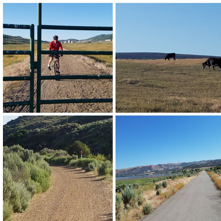
The majority of the trail is gravel.
Portions of the trail are adjacent to private property and you will encounter gates to open and shut to keep animals contained. Be sure to remain on the trail and be respectful of their property.
The landscape transitions from volcanic canyon to wetlands and farms. Some of the wildlife you may encounter includes, fox, bald eagles, moose, deer, rabbits, and beavers. You may want to bring binoculars with you.
Echo Reservoir has recreational boating and fishing and is the perfect place to rest for a picnic and swim before making your return trip back to Park City. If making the roundtrip loop is more than you would like to do, an alternative would be to have someone drop off the trail users and to meet them at Echo Reservoir. See the map for entry points to the trail for additional options.
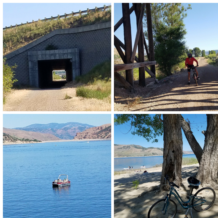
Echo Reservoir is a great place for a picnic and swim at the end of the trail.
Favorite Millcreek Canyon Area Hikes

The Salt Lake area is a great place to live or visit if you enjoy access to a variety of urban activities, but it also offers easy access to some wonderful hikes, if you want to get away from the fast-paced city life, grab your hiking shoes from the closet and take a break to rejuvenate yourself and de-stress by getting out in nature as well as benefit from a bit of exercise. Even a 10-minute walk in some of the city parks can be helpful, but if you’re more ambitious and have more time, here are some of my favorite Millcreek area hikes
Grandeur Peak – This is a moderate hike – a 8,299 foot summit, that is dog friendly, and can take from about 3 to 4 hours. You can start from either the Church Fork trailhead in Millcreek Canyon, or take the more direct (steeper) route from the west. If you go up Millcreek Canyon, they charge a $3.00 fee when you leave the canyon, to help maintain the canyon’s facilities. The western route is great if you’re time is limited. You can take your dog with you, but they recently are asking for dogs to be leashed from the west. In Millcreek Canyon, dogs can be off leash on odd-numbered days and since you’re starting at a higher altitude, the hike is easier and not quite as steep. Grandeur is one of my favorites when I am looking for a quick getaway. https://utah.com/hiking/grandeur-peak
Mount Olympus – is an easily accessed dog-friendly trail from Wasatch Boulevard that offers some spectacular views of the Great Salt Lake and the Salt Lake area. This hike would be a step above the Grandeur hike, the summit is 9,030 feet, and although there’s a moderate trail for the first third of the way, the trail does get somewhat steeper after crossing the creek. When you reach the point where the trail goes through the forested area just above the switchbacks, you are on your way to the upper ridge. From the upper ridge, you follow the trail north to some rock scrambling along the trail to the peak. There are some sections that you may have to help your dog get up the rocks. https://www.alltrails.com/trail/us/utah/mount-olympus-trail
Pipeline Trail – if you’re looking for a relatively easy flat hike that is accessed in Millcreek Canyon. It is a popular hike for runners, bikers, and dog walkers and offers some nice views. Bikes are allowed on the trail every day but on the upper Millcreek trails they are only allowed on even-numbered days. Dogs can be off-leash on odd numbered days. The trail can be accessed from several trailheads – I usually start from just above and across from the Porter Fork trail. If you are ambitious enough to hike all the way (about 6 miles) to the western end there are some nice views of the Salt Lake valley. https://www.trailrunproject.com/trail/7002438/pipeline-trail-burch-hollow-millcreek-canyon.
Salt Lake Overlook Trail – Is about a 4½ mile out and back easy to moderate Millcreek Canyon trail that is shaded for most of the hike and is also a dog-friendly trail. You will begin the hike at the trailhead next to the Mill Creek Inn and you will be taking the Desolation Trail. There are some nice views when you get to the rock outcroppings at the end of the hike. You won’t see as many people on this trail as on the Pipeline Trail. https://www.alltrails.com/trail/us/utah/desolation-trail-to-salt-lake-overlook
Mount Aire – this moderate hike is a little over 3½ miles out and back from the Elbow Fork trailhead in Millcreek Canyon. However, in the winter, the road is closed at the Maple Grove picnic area and the hike would be about 7 miles out and back. From the peak at 8,621 feet, you can enjoy some great views of Millcreek Canyon, as well as Parleys Canyon and the Salt Lake Valley. This would also be a great snowshoe hike in the winter that is safe from avalanches.
Dog Lake & Desolation Lake – A 5 mile out and back trail to Dog Lake is accessed from the upper parking area at the end of the Millcreek Canyon road. Dogs are allowed on the trail on odd days and bikes are allowed on even days to Dog Lake, but if you go all the way to Lake Desolation, dogs are not allowed. The trail is heavily used in the summer months, but is really peaceful in the winter for cross country skiing. However, in the winter, it is much longer because the Mill Creek road is closed at Maple Grove. The lakes can also be accessed from about 9 miles up Big Cottonwood Canyon at the Mill D North Fork trail. https://www.alltrails.com/trail/us/utah/dog-lake-trail
Alexander Basin & Gobblers Knob – Gobblers Knob, at 10,246 feet, is the highest summit on the ridge dividing Big Cottonwood Canyon and Millcreek Canyon. It can be accessed from either canyon, but I usually go by way of the Alexander Basin trail, where the trailhead is about 8½ miles up Millcreek Canyon road. Again, the road is closed in the winter so it’s easiest accessed in the summer months. It is another moderate hike to Alexander Basis where there are some great wildflowers, and a resident moose that likes to hang around the area. If you like great views of the Wasatch Mountains, go up from the basin to Gobblers Knob and from there you can hike west along the ridge to Mt. Raymond. https://www.summitpost.org/gobblers-knob/152266
