
 Facebook
 X
X
 Pinterest
 Copy Link
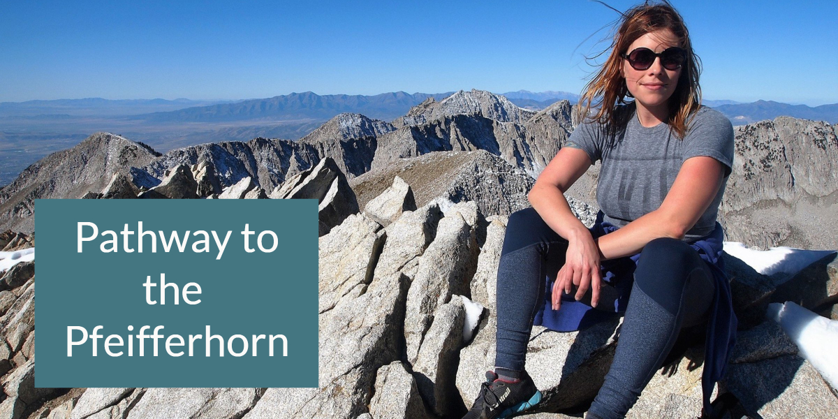

The pathway to the Pfeifferhorn Peak is a popular 10.6 mile out and back trail with an elevation gain of 3,792 feet. It is also known as the “Little Matterhorn”. Although it has locally been known as the Pfeifferhorn after the death of Charles Pfeiffer in 1939, the name was officially changed in 2013 in recognition of the former President of the Wasatch Mountain Club. The summit at 11,362 feet is the fifth highest peak in the Wasatch Range, offering beautiful views. The trail is in a protected watershed, so dogs and swimming are prohibited.
Due to the elevation gain and scrambling over rocks, it is recommended for intermediate and advanced hikers. It is advised that you check the weather report before hiking, to avoid dangerous conditions such as avalanche or thunderstorms, depending on the season.
Driving Directions: From Salt Lake City, take I-15 to Exit 295. Turn east on 9000 South, driving 7.2 miles to Little Cottonwood Canyon. When you reach Wasatch Blvd, turn right and continue up Little Cottonwood Canyon for 5.2 miles where you will find the White Pine & Red Pine Trailhead parking lot on the right side of the road.
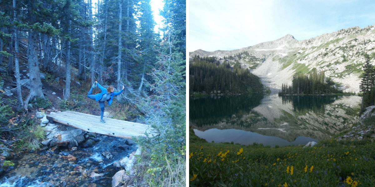
Left: small bridge to Maybird Gulch. Right: Red Pine Lake
Trail: After parking at the trailhead, head south and cross a wooden footbridge over Little Cottonwood Creek. Follow the main trail which curves to the west, and at the split of the White Pine trail and the Red Pine trail you will cross over a second footbridge heading west. The trail heads northwest and then west to the Red Pine drainage. The trail curves to the south, and gradually works its way toward Red Pine Creek. You will come to an old mine on the left and a short ways farther you will see the trail split with the trail heading west going over another small bridge that will take you to Maybird Gulch and eventually to a small lake at the foot of the Pfeifferhorn. But follow the main route straight heading south that will take you to Red Pine Lake.
When you reach the Red Pine Lake head east toward White Baldy and the two Upper Red Pine Lakes. At the upper lakes go south along the ridge to the saddle between White Baldy and the Pfeifferhorn. There are great views from the saddle toward Box Elder Peak and to Mt. Timpanogas. Head west along the saddle toward the rocky ridge that leads you to the base of the Pfeifferhorn. Use care on this ridge as there is a bit of exposure The scamper up to the peak is about 500 feet and is a bit steep but not technical. When you get to the top, take a break, have a snack, and enjoy the views of Lone Peak, Chipman Peak, Hogum Fork, and Maybird Gulch, along with the spectacular sights of Utah Lake and Mt. Timpanogas. Use care when going down to retrace the route you took going up – if you go too far to the west you will be in danger of increased exposure.
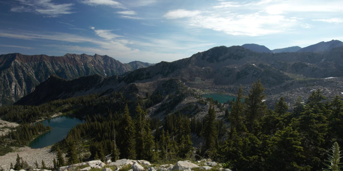
View of Red Pine Lake & Upper Red Pine Lake from upper saddle
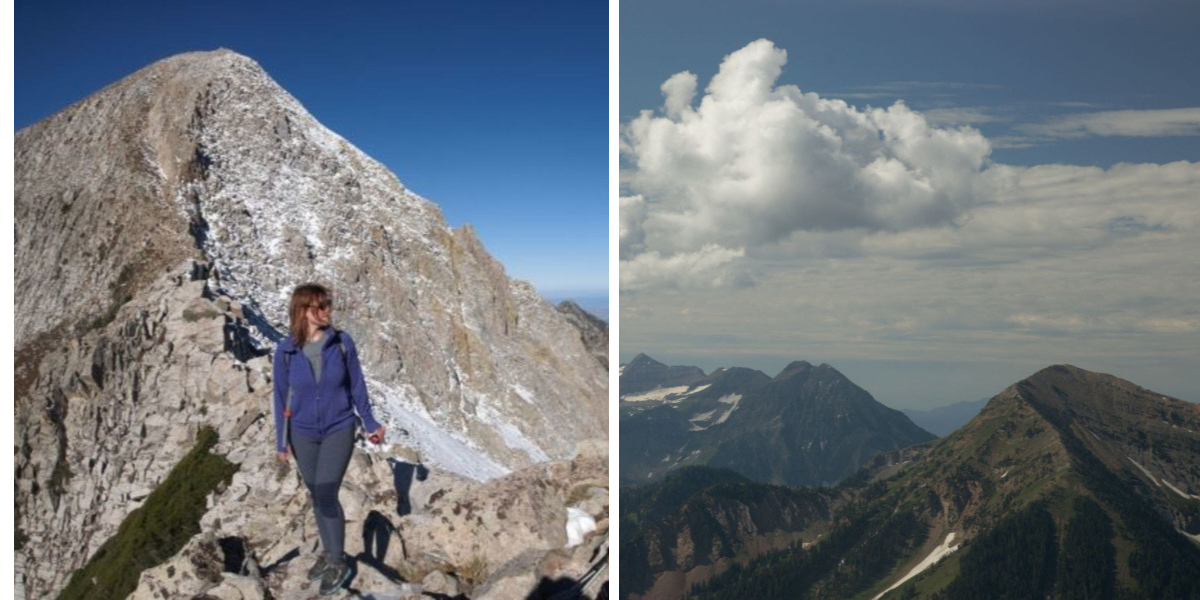
Left: Before the rocky ridge leading to the base of the Pfeifferhorn
Be sure to always be prepared, no matter what season. A storm can come up quickly and at that altitude, lightening can be a real danger, as well as the cold, even in the summer. Dress in layers, bring plenty of water, and protection from the sun.
Other interesting hikes:
The Maybird Gulch Trail – A Trail Less Travelled
Ogden’s Waterfall Canyon Trail
Moonshine Arch – Hidden in Plain Sight
Cascade Springs – Accessible Nature Walk
Take a Seat on the Living Room Hiking Trail
